To start with, let’s look at some examples of LiDAR technology that can give you a taste of what it is and what it is used for. So, the first to mention would be the creation (with no effort from designers) of a marketplace where users can get acquainted with virtual home interiors. And here’s one more: 3D gaming with the use of AR and XR glasses. Again, nearly without involvement of a designer into the process but with the use of advanced LiDAR sensors incorporated in mobile devices.
Can’t wait to know more about LiDAR and how it contributes to the world we live in? We have talked to the experts working in Emerline’s R&D (Research and Development) department to know how LiDAR makes a difference, so your hunger for knowledge will be fed.
 So What Is LiDAR?
Wikipedia defines LiDAR ( Light Detection and Ranging) as “a method for determining ranges (variable distance) by targeting an object with a laser and measuring the time for the reflected light to return to the receiver. Furthermore, the source gives us an understanding that the technology is not new: it was introduced back in 1961 by Hughes Aircraft Company, and was initially created for military use. Later it was involved in the US space program for the creation of a moon surface mapping. And today, in 2021, its use has spread throughout numerous areas, including archeology, geography, forestry, etc.
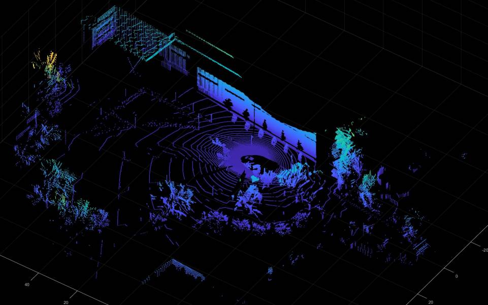
Types of LiDAR Solutions and How Does They Work?
The key components of any type of LiDAR solution is a laser and scanner. And, as we already mentioned in LiDAR definition above, the technology uses remote sensing methods to measure distances. In this way, it allows the creation of 3D representations of targeted objects because it becomes possible to measure the differences in laser return times and wavelengths.
Depending on the functionality, LiDAR solutions are divided into:
Airborne — it measures the time of flight of a signal from a source to its return to a sensor and is commonly used by drones to collect necessary data;
Terrestrial — a ground-based version of the airborne LiDAR that is commonly used on moving vehicles for topographic purposes.
LiDAR Use Cases
Most of us have already experienced how LiDAR technology is used in iPhones where it allows us to measure the distance between two points, find out objects’ measurements, and even check if the surface is straight. But now let’s dive into more specific use cases of LiDAR in different industries.
Agriculture
In agriculture, LiDAR serves as a meaningful contributor to harvesting needs, allowing us to:
- Analyze soil quality, crop conditions, and field state;
- Make precise crop categorization;
- Identify appropriate areas for planting.
Autonomous Vehicles
Wonder how autonomous vehicles become possible? One of the technologies behind is LiDAR that, using lasers, allows vehicles to ‘see’ the surroundings and avoid pedestrians, obstacles, other cars, and objects.
Archeology
With the help of LiDAR, archeologists can get a clearer understanding of the surface, examine vegetation structures, and define topographic variability.
Astronomy
For sure, one of the most prominent use cases of LiDAR is related to aerospace where the technology has already become a history being used for the provision of safe vehicle landing to the moon.
Legislation
Wonder what are the use cases of LiDAR in legislation? Actually there are tens of them, starting from detection of cars that break seed limits to visualization of fingerprints in 3D.
For sure, there are many other areas covered by the use of LiDAR. For example, Emerline’s teams took advantage of the technology for the creation of 3D layouts even before it was introduced to the wide audience with the release of iPhone 12. And there are tens of other brilliant projects this innovator in technology has to show, and will develop. Just take a look at the company’s portfolio to see some of them.
Founder Dinis Guarda
IntelligentHQ Your New Business Network.
IntelligentHQ is a Business network and an expert source for finance, capital markets and intelligence for thousands of global business professionals, startups, and companies.
We exist at the point of intersection between technology, social media, finance and innovation.
IntelligentHQ leverages innovation and scale of social digital technology, analytics, news, and distribution to create an unparalleled, full digital medium and social business networks spectrum.
IntelligentHQ is working hard, to become a trusted, and indispensable source of business news and analytics, within financial services and its associated supply chains and ecosystems